I have a bit of a dilemma. While I am very keen (having been working on it pretty much ALL day!) to share our latest achievement with you, I want you to promise me that you will try not to peek at it until after we have had a chance to put the previously mentioned Guide Books into action. Promise?
Right then, here goes: Now that all the writing for the Guide Books is done; now that all the photographs and illustrations have been chosen and drawn; now that all we have to do (all she says!) is turn it from a muddle of loose pages into a set of logically arranged and expertly bound ready-to-use (weather - which at the time of typing is utterly atrocious! - permitting) booklets, it is time, I feel to turn our attention elsewhere. To maps.live.com
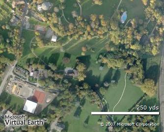
Because, after all the work we did last week marking our chosen places of interest on a rather ancient map of Chateau de Penthes (remember those coloured spots?) I thought it would be an interesting idea to try and make a similar map using an almost up-to-date (I expect you will notice that the tennis courts aren't quite finished in the photo) all-singing, all-dancing online aerial photograph.
And that's where maps.live.com comes in. I have uploaded the written descriptions prepared by each group, plus a suitable photograph and it is now possible to see Class 2i's Guide to Chateau de Penthes by clicking the link.
Similarly, if you go to the maps.live.com website and search for Chateau de Penthes, when you click on collections, you should come up with a list of places of interest in the area, which includes OURS! All very exciting, as I am sure you will agree!


No comments:
Post a Comment